In March, 1996, based on the suggestions provided by scholars and experts, the then Taipei City Hall renamed Jieshou Road in front of the Presidential Office Building Ketagalan Boulevard in commemoration of the history and culture of Taiwan’s indigenous peoples. It was not until then did the people of Taiwan realise that an indigenous people called Ketagalan existed in Taiwan. After all these years, most people still have no realisation about who they are, what happened in the history, and where they are right now.
The truth is Ketagalan do not just exist in the distant past. Until now, some Ketagalan descendants have still been trying to seek for the traces of their ancestors in order to find out their history and identity.
The Ketagalan
in the Taipei Basin
Ketagalan, as part of the Austronesian family of languages, inherited social and cultural traditions unique to the Malayo-Polynesian family. The archaeological sites and unearthed relics pinpoint the link between Ketagalan and part of the Shihsanhang Archaeological Site, indicating the fact that Ketagalan had once been very active residents during the prehistoric age.
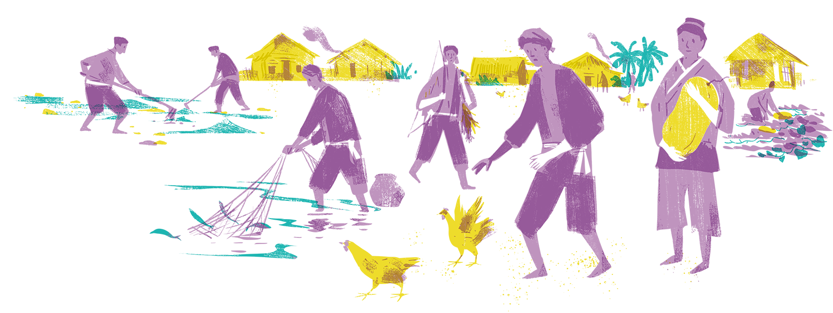
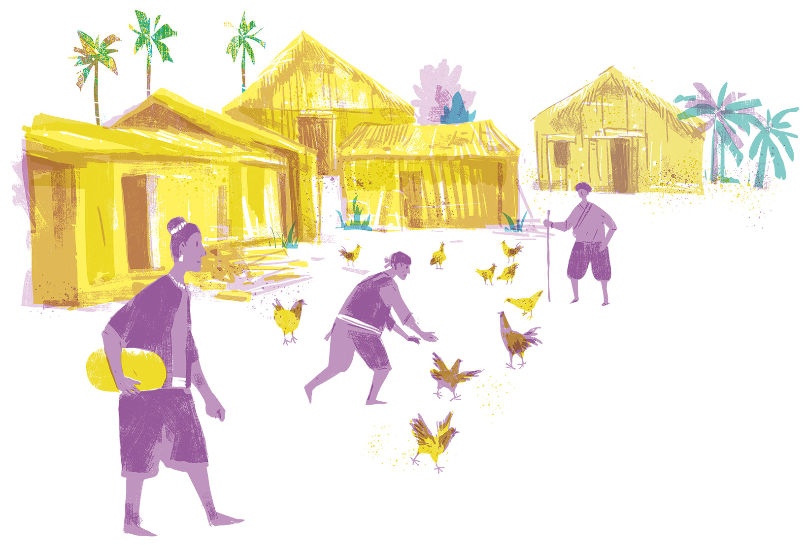
Originally, they dwelled in the Taipei Basin, coastal area of Northern Taiwan, the north-eastern coast, Linkou Plateau, or along Nankan River, etc. They resided at Keelung and Tamsui whose ports were open to the world. Thanks to the geographical location, Ketagalan people had engaged themselves in the maritime commercial activities with Japan and China before the Age of Great Discovery. Since the 17th century, Taiwan had been successively ruled by Spain, the Netherlands, the Zheng’s family, and Qing Empire, resulting in tremendous changes to the traditions and social structure of Ketagalan. The references to Ketagalan as “civilised savages” or “plains savages” in the literature on Taipei area in the Qing Dynasty were made by foreign regimes or non-indigenous peoples.
The census taken by the Netherlands during the 1650’s provides an overview of the number of Ketagalan population before the major structural changes. They found approximately 5,358 indigenous people making up 1,439 households in about 44 indigenous villages in the Great Taipei Basin. Take the most prosperous Taipei Basin as an example. The population of the indigenous people was at a number higher than 3000. The population in each community was not large in scale with only about a dozen to 100 people. Only a few bigger villages such as Bulauoan (the area now around Jiangzihcuei of Banciao District in New Taipei City) or Massauw (now Shihlin District in Taipei) had a population exceeding two to three hundred. The Mandarin literature from the Qing Dynasty used the word “she (Chinese word meaning ‘village’)” to refer to those communities. The examples are Sirongh Village (now Jhonghe District in New Taipei City), Siah-khau Village (now Songshan District in Taipei), or Kipatauw Village (now Beitou District in Taipei).
In the report “Taiwan’s Aboriginal Affairs” published in 1900, the Japanese scholars, In? Kanori, Awana Dennojou, etc. categorised the indigenous peoples in Taiwan for the first time. This book put Ketagalan people residing in the plains of Taipei, Keelung, and Tamsui under the category of “Taiwan Plains Indigenous Peoples,” but did not elaborate on the meaning of the name of the people. In? Kanori travelled to every corner in Taipei to conduct thorough field studies and record oral narratives, which has enabled the historical stories, mythologies, words of Ketagalan language and definition of the words all recounted by the villagers, and images and photos to be kept.
In the description of the genesis of Ketagalan, In? Kanori wrote, “We had originally lived in Sansai. We went fishing and drifted at sea because of a typhoon. Two of the boats arrived here, and we came ashore and established Kivanowan Village. That was thousands of hundreds of years ago.” The account of the oral history further indicated the following: “They were the founding fathers of the Taiwan Plains Indigenous Peoples. Their descendants emigrated to other corners of Taiwan, partly to Yilan and others to Keelung.” Based on this narrative, In? Kanori proposed a bold and renowned hypothesis that Kivanowan Village (now Shuangsi River in Gongliao District of New Taipei City) was the cradle of the indigenous villages in the North of Tamsui and Yilan. This story of two villages sharing a common history and then dividing became the theoretical basis for Ketagalan when they pushed ahead with the revitalisation movement.
Subsequently, with In? Kanori’s underlying theory and comprehensive data from various sources, the linguists, anthropologists, and archaeologists active in the late Japanese Occupation to the contemporary time claimed that to explain the diversity of Ketagalan, there should have been three subgroups. In 1985, Tsuchida Shigeru, a linguist, put forward an intriguing classification system, which puts Ketagalan people living in the east of Keelung River to the north-eastern coast under the category of Basay; those living in the west of Keelung River to the brink of Linkou Basin under the category of Luilang (or perhaps the real Ketagalan people), and those living in Linkou Basin to Taoyuan under the category of Kulon.
Nevertheless, the documents from the 17th century referred Basay people to the residents living in Jinshan and Wanli of the north coast to Fulong in Shuangsi River area of the northeast coast, i.e. Kitapari Village, Kimaurri Village, and Kivanowan Village specified in Qing Dynasty’s report. Basay people made a living on fishing, hunting, and evaporating brine; they had a dexterous hand to make bows and arrows, clothes, and knives and build houses. They were nomadic and business savvy. People who had traded them picked up Bassay language, so that they could communicate with one another. According to the linguistic data from the early 20th century, the Basay language became a common language among the indigenous peoples living in part of Taipei as time passed by, which is the so-called “the spread of Basay language” as coined by experts. The map of language distribution by Tsuchida Shigeru accurately depicts the dynamics of language. With regard to the Luilang people, they gathered at the centre of Taipei Basin, whereas Kulon people scattered in low-elevation mountains and valleys in the form of small villages. Their language and culture are different from Kategalan in the plains.
Retrieving Evidence of Existence
from Old Community Names
Since the Chen Lai-Jhang Settlement Establishment applied to reclaim a vast area ranging from “Leisia and Sirongh to the east, Parecachu and Gandou to the west, the foot of Singjhih Mountain to the south, to Pourompon to the north” in 1709 (48th year of the reign of Emperor Kang-si), years after Taiwan was ruled by the Qing government, non-indigenous people closed in on the indigenous territory at Great Taipei. The once green fields of luxuriant grass and with deer running on it had been replaced by rice paddies, and the systems of non-indigenous people’s streets and towns had completely taken over. The indigenous peoples were stripped of their lands and engulfed by the non-indigenous ones. Even so, the evidence of their existence is still traceable today.
The names of Ketagalan communities are quite unique. For example, names such as Pourompon, Catayo, Kitapari, Kizingan (for places), and Sirongh (for New Taipei Municipal Sioulang Elementary School), Pataauw (for Beitou District), and Datun (for mountain) are used for places, but not only that, they have even been adopted as names for roads, stations, schools, administrative districts, and mountains and rivers. The documents recording land relations (relationships of people to land) were the rare data produced by Ketagalan people first-hand. Although these documents were drafted on behalf of the parties concerned, they gave a vivid account of how indigenous people in question dealt with their land and properties. With a yellowish tinge and musty smell, these documents recorded the names of communities, land, and people with inky handprints as well as the seals of indigenous officials and supervising translators. Every pen stroke, every word depicted subtle changes in the lives of indigenous peoples and the society.
Nevertheless, before the 1980’s, Ketagalan as part of the indigenous peoples kept a low profile. After martial law in Taiwan was lifted, there was a growing interest among the public in delving into indigenous cultures, making those who had long considered themselves to be orthodox Chinese descendants reflect if their ethnic ideology was too rigid. Thus, the exploration of collective memory and self-identity of indigenous peoples took place. At this time, the household registration census records became extremely important references.
Japan established the household registration system in 1906, and since then, every change in a person’s life from birth, marriage/divorce, migration, having/raising children, death, and so on, had been recorded on the household registration transcript. In addition, thanks to the complex structure of ethnic groups, the colonist Japan designed an “ethnicity column” to show status of each group. Words such as “Fu,” “Guang,” “Civilised,” and “Uncivilised” were used on the records. “Fu” and “Guang” referred to people who used Hokkien or Hakka to engage in daily conversations, whereas “Uncivilised” meant “Uncivilised savages” living in special administrative districts (the so-called “indigenous areas”) and general administrative areas such as the indigenous peoples of Pangcah, Pinuyumayan, and Paiwan residing in Hualien and Taitung. “Civilised” was short for “civilised savages,” which had been used by the Qing government. The term referred to the Taiwan Plains Indigenous Peoples in the general administrative areas. From these key words in the household registration census records, people would be able to appraise one’s ethnic background.
Emergence
of Ketagalan
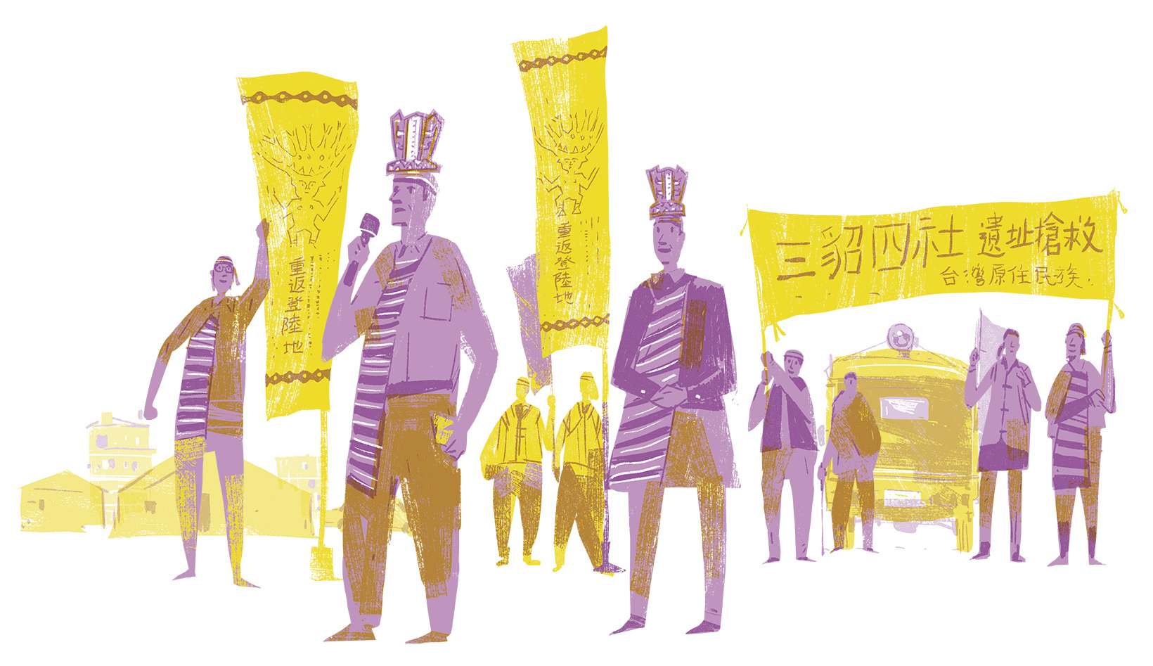
The ethnic identity revitalisation movement of Ketagalan was triggered by the battle over the budget of Taipower’s Fourth Nuclear Power Plant in the Legislative Yuan in July, 1994. The then legislator, Wong Jin-Jhu, called a press conference entitled “Saving Cultural Relics, Terminating the Fourth Nuclear Power Plant Project.” She invited a descendant of Ketagalan, Mr. Lin Sheng-Yi, to address the issues of the movement history of Kivanowan Village and the preservation of Yanliao Archaeological Site as an anti-nuclear appeal to the press. Due to this event, the fact that indigenous peoples had once existed in Great Taipei Area and its history and culture drew public’s attention with Taipei City Government changing Jieshou Road into “Ketagalan Boulevard.” Now, the public of Taiwan finally know who “Ketagalan” are through the publicity of Taipei throughout the country, the official announcement and promotion of policies, reports in magazines, and in newspapers.
The emergence of Ketagalan resulted from the controversy over the Fourth Nuclear Power Plant in Taiwan, but the subsequent development focused on reminiscing about its origin and past. Part of the advocates of revitalisation movement assumed that Ketagalan were the founding ancestors of all indigenous peoples in Taiwan, based on In? Kanori’s theory that Kivanowan Village was the place where the two big groups of people stepped ashore and later on separated into Taipei and Yilan along with the rich archaeological evidence in Kivanowan area and the oral narratives of the “landing site of ancestors.” In 2003, the movement participants returned to Kivanowan Village to commemorate the landing of ancestors. Also, they incorporated Shansi Temple, which was once connected with Sanshi Province in China and worshipped by indigenous peoples for ancestry, into the mythology of Sanasai. This mythology is shared by the indigenous peoples living in the North and Northeast of Taiwan, Yilan, Hualien, and Taitung.
Additionally, other elements such as underground passages, smoky caves, ritual grounds, pyramids, etc. were added to the theory of Kivanowan Village as landing site to develop the new and famous thesis, “Mt. Cising, the Cradle of Ketagalan Civilisation.” The advocates claimed that Ketagalan people were the descendants of aliens, and left behind them the remains of Ketagalan Kingdom, which centred on the pyramid on Tianping in Mt. Cising. “Tianping” was the flat region surrounded by the main peak, eastern peak, and southern peak of Mt. Cising. Other relevant relics include a triangle worshipping stela, a crescent pond, tombs, man-made Stonehenge, and stone totems, etc. Although these statements are not supported by solid evidence, they still attract many believers and enrich the historic texts of Ketagalan Civilisation.
All in all, Ketagalan did not only exist in the past, but also can be seen in Taiwan’s modern society. The mythical names of places, riddle-ridden documents, special family names, and status recorded in the past registration records serve as a bridge to the past; as a result, we can understand and connect ourselves to history at large. We will even find out that we are the main players because we have that DNA in our blood. With this data, no matter what conclusions we come to, we will be able to trace the history of our family, the identity of our people, and the root of who we are.
Related articles